Experts warn of connections between microorganisms and climate change

More than 30 microbiologists from 9 countries have issued a warning to humanity

Atlantic Archipelagos Research Consortium
Digital Humanities at The University of Georgia
More than 30 microbiologists from 9 countries have issued a warning to humanity
UGA is among the 16 academic and four non-academic partners in the consortium
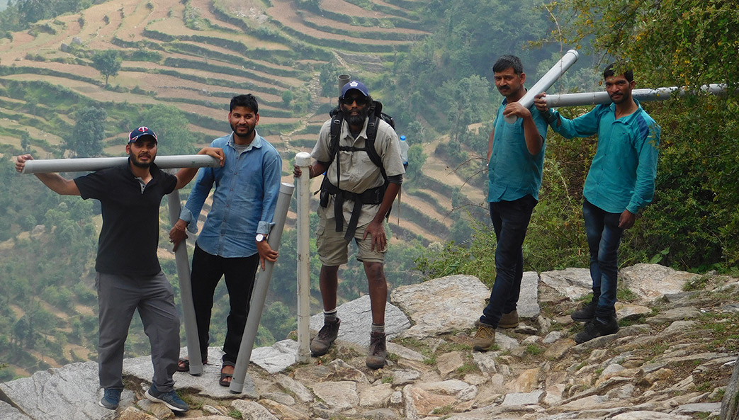
Photo courtesy of Harish Bisht
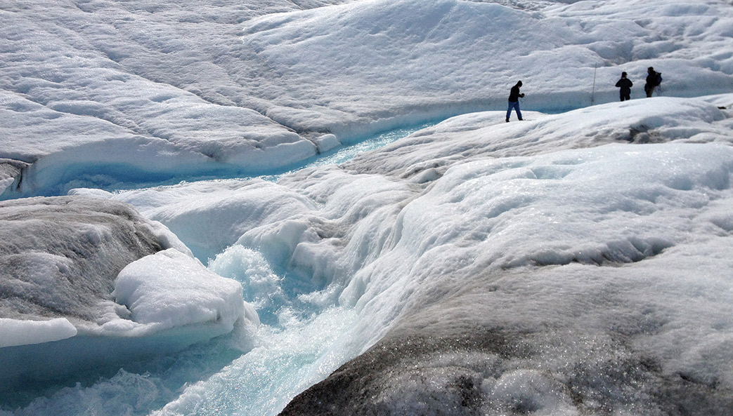
“I love glaciated environments,” says David Porinchu (center), associate professor of geography. “I’ve always wanted to work in the Himalayas, and it doesn’t get more glaciated than that.” Porinchu spent six months in India last year as a Fulbright Scholar, collecting lake sediment cores from 15 lakes across an 11,000-foot range of elevation. In May, he and his team—including students and staff from Kumaun University—hiked to Deoria Tal (“tal” means “lake”) in the Garhwal Himalayas in the state of Uttarakhand. (Left to right) Harish Bisht, Ph.D. student; Prem Bisht, department staff; Porinchu; Bittu Singh, department staff; and Kishan Kotliya, a local driver, carried tubes used to protect lake sediment cores. Master’s student Emily Niederman is analyzing the cores—which represent from 100 to 5,000-plus years, depending on length—to reconstruct the long-term evolution of climate in this region.
UGA will evaluate two promising directions in the future development of the Energy Exascale Earth System Model
The university’s 86 weather stations record data 24 hours a day, seven days a week across Georgia
Professor shares advice on staying calm and clear-headed despite the uncertainties of a major storm
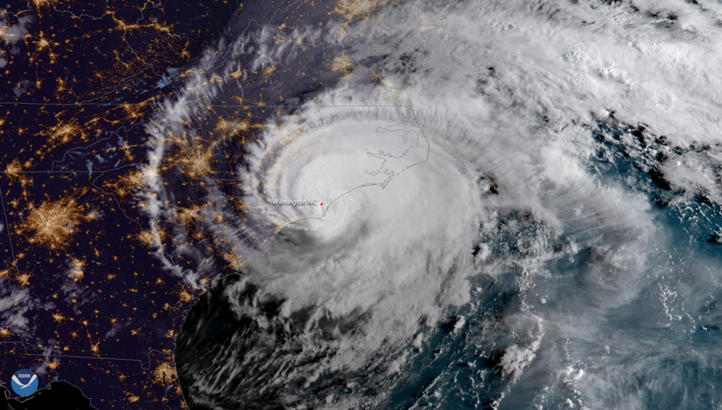
In June, the one-square-mile-plus bit of Virginia known as Tangier Island gained national attention when President Donald Trump called the town’s mayor, James “Ooker” Eskridge, with a message of reassurance. The phone call followed a CNN report that Tangier Island—and the homes of about 450 inhabitants—likely would be swallowed by the Chesapeake Bay within two decades.
The president told Eskridge “not to worry about sea-level rise,” according to a CNN follow-up story, but residents are worried, and with good reason. The island has lost two-thirds of its landmass since 1850, according to research published in the online journal Scientific Reports in 2015, and continues to lose about 15 feet of coastline every year.
Tangier Island residents won’t be the first U.S. refugees forced off their land by rising sea levels. Kivalina, Alaska, is expected to be underwater by 2025, and officials in Isle de Jean Charles, Louisiana, are negotiating resettlement to drier land. But they’ll be followed by others in higher profile coastal communities, places like Miami Beach, North Carolina’s Outer Banks and Savannah. The debate so far can be summed up thusly—to save or not to save? How do we choose who, and where, to save?

Yards on Tangier Island, Virginia, flood regularly. Scientists estimate that the island may be swallowed by the Chesapeake Bay within 20 years. Photo: U.S. Army/Patrick Bloodgood
These questions will persist as more and more coastal communities contemplate the merits—and costs—of staying versus retreating in the face of the rising tide. But one UGA researcher is asking different questions.
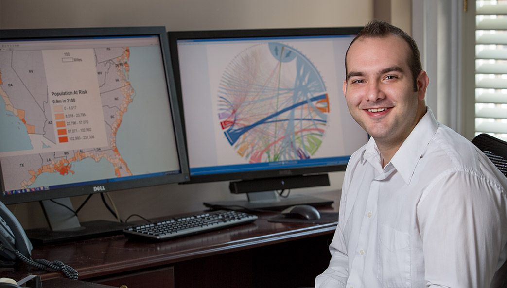
In a 2016 paper published in Nature Climate Change, Mathew Hauer predicted that rising ocean waters could displace 13.1 million people by 2100. This estimate led to an important question: Where will they go? He provided an answer in April, publishing another paper in Nature Climate Change that identified Atlanta, Houston and Phoenix as top destinations for those forced to relocate.
The study is the first attempt to model the destination of millions of potentially displaced migrants from heavily populated coastal communities.
“We typically think about sea level rise as a coastal issue, but if people are forced to move because their houses become inundated, the migration could affect many landlocked communities as well,” said Hauer, a faculty member who leads the Applied Demography Program at UGA’s Institute of Government.
Two factors are driving rising sea levels—the expansion of ocean water as it warms and an increase in volume as ice sheets melt. Sea level has risen 8 to 9 inches worldwide since 1880, and projections for 2100 estimate further increases ranging from 1 to 12 feet.
While sea-level rise assessments may help plan for the development of critical infrastructure, few research studies have grappled with where displaced people and families will go. No previous studies model how migration caused by sea-level rise will affect population other than in the directly affected coastal areas.
Relationships between environmental stressors and migration are highly complex, as responses range from short-term, temporary migration to permanent, long-distance migration. Sea-level rise is a unique threat because it permanently converts habitable land to uninhabitable water.
In the new study, Hauer combined migration simulations with his estimates of populations at risk to predict the numbers of potential sea-level rise migrants and their destinations in the U.S. over the coming century.
“Some of the anticipated landlocked destinations, such as Las Vegas, Atlanta and Riverside, California, already struggle with growth management challenges,” he said. “Long-range planning that anticipates a possible influx of coastal migrants and increased demand in areas including housing, water, infrastructure, transit and social services could help lessen future challenges.”
This story appeared in the fall 2017 issue of Research Magazine. The original press release is available at http://news.uga.edu/releases/article/sea-level-rise-could-reshape-cities-inland/.
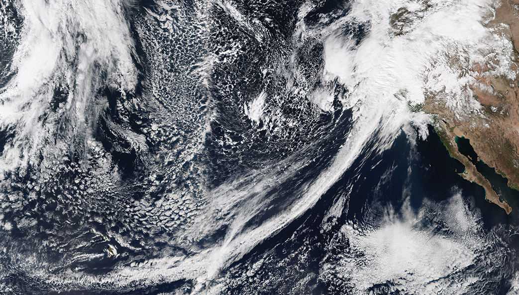
This same phenomenon caused flooding in California over the last month.
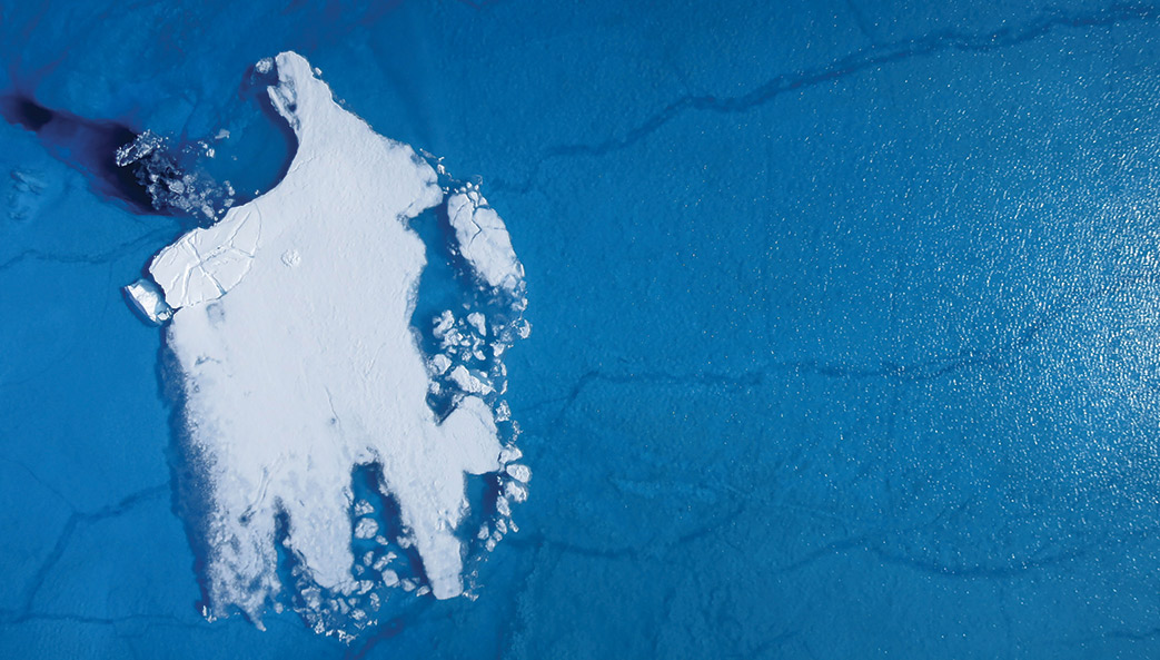
Over the past several decades, scientists have observed a significant increase in the melting of glacial land ice on the island of Greenland, spurring concerns about global sea level rise and the long-term effects of atmospheric warming. Thomas Mote, a Distinguished Research Professor of Geography at UGA, was part of a team that used satellite imagery to document an extreme ice sheet melt in 2012. On average, about half of the surface of Greenland’s ice sheet naturally melts in the summer. In 2012, an estimated 97 percent of the ice sheet surface had thawed by mid-July.
“Greenland is very much a harbinger of some of the climate change that we have seen over the latter century,” said Mote. “This was the first time we witnessed almost all of the ice sheet melt in the three decades since satellite surveillance began.”

In addition to understanding what causes these extreme melting events, researchers also want to know what happens to the meltwater once it enters the ocean. Renato Castelao, an associate professor of marine sciences at UGA, helped create a simulation that tracks meltwater runoff under a variety of atmospheric conditions.
According to the model, wind and ocean currents often transport meltwater from Greenland’s east coast around the southern tip of Greenland on a westward journey that can take upward of 60 days. Meltwater from the west coast of Greenland is typically kept pinned to the coastline by strong trade winds, which push in northward toward Baffin Bay.
“Understanding the fate of meltwater is important, because research has shown that it can carry a variety of nutrients, which may impact biological production in the ocean,” Castelao said. “The meltwater that comes from the east coast could have different qualities from the meltwater on the west coast, including different nutrient compositions. We need to take the origins of this meltwater into account when we study the effects of ice sheet melt, as it could impact the oceans differently depending on where it comes from.”

In a study published last year, Mote (featured above) and colleagues from universities around the world found evidence that links melting ice in Greenland to a phenomenon known as Arctic amplification—faster warming of the Arctic compared to the rest of the Northern Hemisphere.
“Last year was unique in the extensive melting that occurred on the northern reaches of the ice sheet, an area that usually has rather modest melt compared to Southern Greenland,” Mote said. “We identified an unusual configuration of the jet stream toward northern Greenland that led to this melt pattern.”
The Greenland ice sheet, which covers about 80 percent of Greenland, is the Earth’s second largest after the Antarctic ice sheet. If its layers of ice were to melt entirely, it would raise average global sea level by about 7 meters, or almost 23 feet. Learning more about the drivers of melting is essential to discerning how much sea level will rise in the future and how Greenland’s freshwater runoff will affect ocean circulation and ecology.
By Alan Flurry
The Neolithic Revolution—the shift from hunting and gathering to agriculture that led to permanent settlements, development of social classes and, eventually, civilizations—remains perhaps the key turning point in human history.
Understanding the conditions that allowed for—and perhaps led to—this transition that began about 12,000 years ago represents an important benchmark for how humans and animals respond to environmental changes. A new study published in the journal PLOS ONE by a University of Georgia researcher used geochemistry to analyze bones from archeological sites to establish new connections between prehistoric mobility and adaptation.
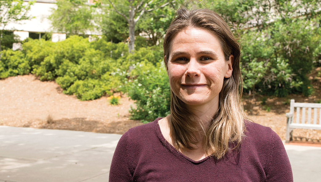
“It’s important to keep in mind that this is a time of very stark climate change, and depending on where you were in the world, environments responded and sea levels rose rapidly,” said Suzanne Pilaar Birch, an assistant professor of anthropology and geography in the UGA Franklin College of Arts and Sciences.
“The way that people were living in these small groups before agriculture would have influenced how they adapted to environmental changes and whether or not they ultimately adopted this agricultural lifestyle themselves.”
The paper’s primary finding suggests that scientists can use variability in stable isotope signatures found in teeth of herd animals to reconstruct their mobility in the past, and this, in turn, is useful for archaeology because it can reveal more information about hunter-gatherer mobility and how they might have adapted in response to climate and environmental change.
One way that archaeologists can “see” how people adapted to these changes is by looking at the remains of what they were eating.
“In this particular instance, it’s the time period right before the transition to farming from hunting and gathering in Croatia, which is also important because of its crossroads location between Europe and Southwest Asia, as agricultural lifestyles were moving east to west,” Pilaar Birch said.
In the case of these hunter-gatherers living on Croatia’s Istrian peninsula, the paper documents a large proportion of elk, chamois and ibex bones from three caves. If these animals are the primary source of protein, their behavior becomes important. If they are migratory, as many large herd animals like elk are known to be, that in turn dictates the movements of those people—on an annual, seasonal and daily basis.
But one of the problems scientists have using the mobility of prey as a way to potentially understand how people were moving is that the modern behavior of these animals might be different than it was thousands of years ago, especially when considered in the context of not only the environmental changes but also the effect that humans have had on the planet during the historical period.
“The challenge is, how can we reconstruct behavior without seeing it?” she said. “What more information can the bones of these animals give us?”
Different isotopes of elements such as oxygen and carbon recorded in teeth and bones can be used to reveal clues about mobility and diet. In the case of the elk in this study, the researchers found that by using stable oxygen isotopes, the behavior of the deer likely changed from the earlier period, where they were likely moving over larger distances on a seasonal basis, to the later period, where their mobility was seemingly more restricted.
This in turn would have had implications for the people who were dependent on these elk and changed the way they moved about the region as well, potentially causing them to settle into one region rather than moving over longer distances.
“In the long run, this may have made local populations more receptive to the sedentary lifestyle accompanying agriculture as it spread westwards from the near east, across the Balkans and into Europe,” Pilaar Birch said. “This may have relevance for our understanding of at least one potential way agriculture spread from place to place thousands of years ago.”
The study, “Late Pleistocene/Early Holocene Migratory Behavior of Ungulates Using Isotopic Analysis of Tooth Enamel and Its Effects on Forager Mobility,” is available at http://journals.plos.org/plosone/article?id=10.1371%2Fjournal.pone.0155714.
Study co-authors are Preston Miracle, University of Cambridge; Rhiannon Stevens, University College London; and Tamsin O’Connell, University of Cambridge.
By Jessica Luton
A new study provides the first evidence that links melting ice in Greenland to a phenomenon known as Arctic amplification—faster warming of the Arctic compared to the rest of the Northern Hemisphere as sea ice disappears.
The findings show that the predicted effects of Arctic amplification, as described in previous studies, occurred over northern Greenland during summer 2015, including a northern swing of the jet stream that reached latitudes never before recorded in Greenland at that time of year.
The study, published today in Nature Communications, included researchers from University of Georgia, Columbia University, University of Liege, City College of New York, University of Leeds and the University of Sheffield.
The Greenland ice sheet, Earth’s second largest after Antarctica, holds enough ice that if it were to melt entirely, it would raise average global sea level by about 7 meters, or almost 23 feet. Learning more about the drivers of melting is essential to discerning how much sea level will rise and by how much in the future and how Greenland’s freshwater runoff will affect ocean circulation and ecology.
“During the past two decades, we have seen increasing melt from the Greenland ice sheet, culminating in a very large melt event in the summer of 2012,” said study co-author Thomas Mote, a University of Georgia professor in the department of geography. “Last year was unique in the extensive melting that occurred on the northern reaches of the ice sheet, an area that usually has rather modest melt compared to southern Greenland. We identified an unusual configuration of the jet stream toward northern Greenland that led to this melt pattern.”
Rising global temperatures are melting Arctic sea ice, leaving dark open water that absorbs more solar radiation and causes faster warming in the Arctic. While Arctic amplification is well documented, its effects on the atmosphere are still debated. One theory among scientists is that the shrinking temperature difference between the Arctic and the temperate zone will lead to a slowing of the jet stream. Normally, when the jet stream circles the northern latitudes, the frigid polar air is separated from warmer air in the south. Slower winds, however, could create wilder swings that would allow warm, humid air to penetrate farther north.
“The Greenland ice sheet is one of the most important contributors to sea level rise since 2000,” Mote said. “Moreover, some recent work has shown how meltwater runoff can affect ocean productivity and circulation in southern Greenland. However, we don’t yet have a good understanding of how increased melt in the north might affect surrounding oceans and the dynamics of the ice sheet.”
Northwest Greenland’s summer melt started last June when a high-pressure ridge squeezed off from the jet stream and moved westward over Greenland and hovered over the Arctic Ocean, the study shows.
Clear skies and warmer weather in northern Greenland from this high-pressure system resulted in record setting surface temperature and meltwater runoff in the northwest. With less summer snow falling and melting underway, northern Greenland’s reflectivity also decreased and the water absorbed more heat from the sun, further increasing melting.
Northern Greenland’s wind patterns also changed from the usual west to east direction to east to west. Only two other years on record show east to west wind averages in July and both were slower. Further, the jet stream’s northernmost ridge swung nearly 2 degrees farther north than the previous July record, set in 2009.
The same atmospheric pattern had a different impact on southern Greenland, where new melting records have been set over the past decade. The south saw more snow during summer 2015 and less melting than previous years.
“How much and where Greenland melts can change depends on how things change elsewhere on Earth,” said the study’s lead author Marco Tedesco, a research professor at Columbia University’s Lamont-Doherty Earth Observatory and adjunct scientist at NASA Goddard Institute for Space Studies. “If loss of sea ice is driving changes in the jet stream, the jet stream is changing Greenland, and this, in turn, has an impact on the Arctic system as well as the climate. It’s a system, it is strongly interconnected, and we have to approach it as such.”
The authors don’t fully confirm Arctic amplification as the cause of the warming, but say the results of their study fit the description of possible effects as predicted by other researchers. Whether the patterns seen in 2015 will continue in the future is uncertain. This spring, Arctic sea ice set another record low for its maximum extent for the year.
“Greenland also experienced early season melt in early April of this year comparable to April 2012. Record-setting melt occurred later that summer, but it is too early to tell whether the same will hold true in 2016,” Mote said.
Additional co-authors are Xavier Fettweis of University of Liege; Jeyavinoth Jeyaratnam, James Booth and Rajashree Datta of City College of New York; and Kate Briggs of University of Leeds.
The study, “Arctic cut-off high drives the poleward shift of a new Greenland melting record,” was supported by funding from NASA’s Interdisciplinary Data Science Program, NASA’s Cryosphere Program and the National Science Foundation and is available atwww.nature.com/ncomms/2016/160609/ncomms11723/full/ncomms11723.html.
By James Hataway
Jill Anderson, an assistant professor of genetics in the University of Georgia’s Franklin College of Arts and Sciences, has received a $1.1 million grant from the National Science Foundation Early Career Development Program to study the effects of climate change on plants.
CAREER awards are among the NSF’s most prestigious, and they support junior faculty who exemplify the role of teacher-scholar and the integration of education and research.
Anderson’s project tests whether plants will be able to survive on a warming planet by using a mustard plant species called Drummond’s rockcress as a model. Native to the Rocky Mountains, Drummond’s rockcress can grow at elevations as low as 5,000 feet and higher than 12,000 feet, and its range extends from Alaska to Arizona.
“This plant has been exposed to variable climates throughout its evolutionary history, and studies suggest that it has adapted well to changes in climate brought on by events like the expansion and contraction of glaciers,” said Anderson, who also has a joint appointment in UGA’s Odum School of Ecology. “Now we want to see if this plant can do the same thing when faced with rapid changes in climate brought on by human activities.”
Anderson is particularly interested in the adaptations that allow plants like Drummond’s rockcress to “migrate” to new areas in response to changing climates.
As the atmosphere warms, for example, seeds may begin to germinate at higher elevations, allowing plants to move into environments that were previously too inhospitable.
“Plants can also shift how they behave in response to changes in the environment,” said Anderson, who also serves as a member of UGA’s Plant Center. “We know that Drummond’s rockcress is flowering about 13 days earlier than it was in the 1970s, but we want to find out how much of that is an adaptive response to earlier springs or how much of that is just a symptom that the plant is stressed.”
Anderson and her colleagues will conduct large-scale field studies and laboratory experiments to see if natural plant populations have enough genetic diversity to adapt to a rapidly changing climate. The lessons they learn from studying Drummond’s rockcress may help identify plants more or less vulnerable to climate change, which could influence conservation efforts for both natural and agriculturally important plants.
“There will be situations in which plants can’t keep up with climate change, and several scientists are researching whether we should relocate plants to areas that will be more hospitable in the future,” she said.
For the educational component of her award, Anderson will expand an ecology course for high school students in Colorado, where she does her fieldwork.
Students enrolled in the course conduct their own independent research projects, and they receive a full high school science credit for successfully completing the class.
“This grant expands the high school project by bringing in teachers and teachers in training so we can give them the information and resources they need to take their students outside and do field biology,” Anderson said.
Anderson and her colleagues will work with the teachers to build lesson plans based on fieldwork, which they will post online so that other teachers around the country can use the same ideas for their own classrooms.
A new study by University of Georgia researchers could help protect more than 13 million American homes that will be threatened by rising sea levels by the end of the century.
Warming climate may release vast amounts of carbon from long-frozen Arctic soils